Showing posts with label Roxburgh Castle. Show all posts

Sunday, March 10, 2019

Camelot by Kelso

Not many people go to Roxburgh Castle nowadays. It's a nice walk along the Borders Abbeys Way where Teviot joins Tweed, but nothing much to see...


In most history books it is only referred to as the place where King James II of Scotland was killed in 1460 by his own cannon exploding beside him (his nine year old son was then crowned James III in Kelso Abbey).

But before it was destroyed, Roxburgh Castle and its associated town to the east on what is now Friars Haugh, were a significant centre of power. In the time of King David I it was for a time the de facto capital of Scotland.

In the Middle Ages the town had as much importance as Edinburgh, Stirling or Perth; indeed it was the first recorded Scottish burgh. Situated on the Tweed, upstream from the major port of Berwick, and close by Dere Street, it was a substantial market town, exporting large quantities of raw wool and hides to Bruges, Ghent and beyond.

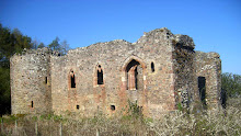
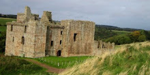
At that time the castle may have looked like this (with thanks to Andrew Spratt).


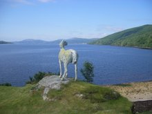
Roxburgh has also been closely associated with King Arthur, inspiring leader of a well disciplined mounted force that won a reported 13 battles, mostly in the lands north of Hadrian's Wall.

Writing about Roxburgh in his 'History of the Borders', historian Alistair Moffat writes, "Cavalry forts have special requirements and the castlemount and the wide haughland between the Tweed and the Teviot provide all of them...The ancient Celtic name of Roxburgh Castle was preserved and before the Angles came to change it, it was called Marchidun: in Old Welsh, the Horse Fort. Medieval and modern Arthurians would have preferred to call it Camelot."

Tuesday, January 07, 2014

Roxburgh Castle

It's difficult to imagine, as I walk by the River Teviot to ruinous Roxburgh Castle, that King David I (1124 - 1153) governed Scotland from here, that it saw royal marriages and births, and was one of the principal strongholds of Scotland, ceded to England (with Edinburgh and Stirling) after the capture of King William 'The Lion' in 1174.


It's a wet and windy January afternoon and it's also hard to imagine an iron cage hanging from these walls, a cage containing a king's sister. She was Mary, sister to Robert the Bruce, held here by the English, 'exposed to public view' from 1306 to 1310, then removed to a convent, (presumably to stop a valuable hostage from dying of exposure). She was released after the Battle of Bannockburn (1314) in exchange for English noblemen.

Ah yes! Bannockburn. There's a happier story! Our last 'home win', 700 years ago on 23 and 24 June. And Roxburgh Castle was taken for the Scots by 'Good' Sir James Douglas earlier that same year by creeping up on it with sixty men disguised, they say, as cattle; though sadly we don't have the exact day to celebrate it. This left Stirling as the only Scottish Castle in English hands... fanfare and cue Bannockburn re-enactment later this year.

But returning to Roxburgh, this is what Andrew Spratt (and he's normally pretty good) thinks it looked like.


The two rivers join just below the illustration and the Teviot was partially diverted (top) to surround the castle with water (just like Caerlaverock on the Solway Firth and Old Inverlochy Castle at Fort William).

Roxburgh changed hands between Scots and English 13 times and was eventually destroyed by the Scots in 1460. But this was another bitter and uncertain time: our king, James II, had been killed standing by a canon, firing on English-held Roxburgh Castle from the grounds of Floors Castle across the Tweed.

The magnificent  building that now smiles benignly across the river is a modern structure (of 1721) but well worth a visit. And if you do go, look for the holly tree marking the spot where James II was killed by his favourite canon. And perhaps you will take time to wander up to the thought-provoking ruins of Roxburgh Castle.